

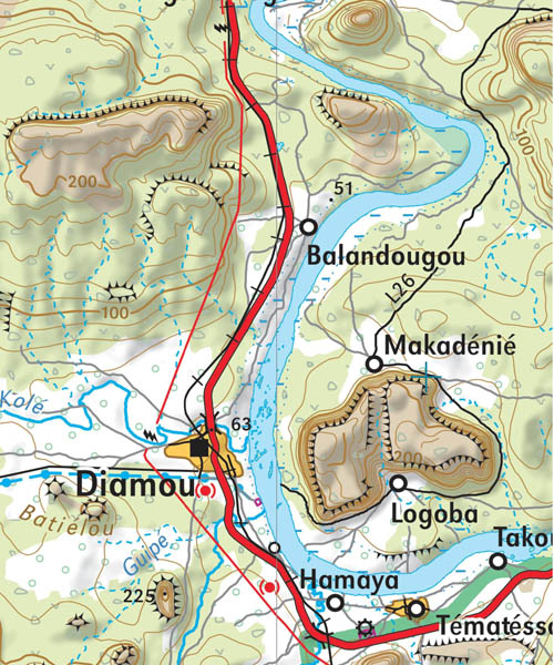
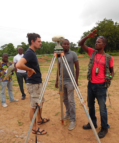
The project to modernise and rehabilitate Senegal's geodetic infrastructure is part of the Land Registry and Security Project (PROCASEF), which aims to put in place land man... Continue reading
L'ingénierie géographique de référence

Senegal/ PROCASEF: national workshop to launch geodetic modernisation work ![]() All equal at IGN FI!
All equal at IGN FI! ![]() Senegal/ PGIIS project: impact of flooding on Kolda and Kedougou
Senegal/ PGIIS project: impact of flooding on Kolda and Kedougou ![]() IGN FI at the heart of the New Copernicus Service Global mapping and monitoring of land cover and tropical forests (LCFM)
IGN FI at the heart of the New Copernicus Service Global mapping and monitoring of land cover and tropical forests (LCFM) ![]() Ivory Coast/ PADA: Report on surveys and stenciling
Ivory Coast/ PADA: Report on surveys and stenciling ![]() MADAGASCAR / CASEF Project: start of land certification operations and support to land offices
MADAGASCAR / CASEF Project: start of land certification operations and support to land offices ![]()


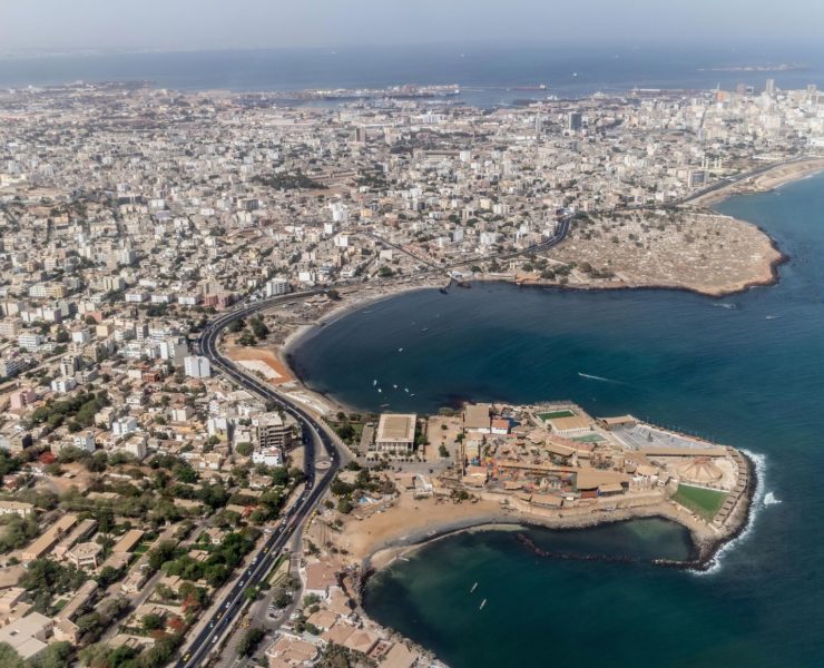
Senegal/ PROCASEF: national workshop to launch geodetic modernisation work
All equal at IGN FI!
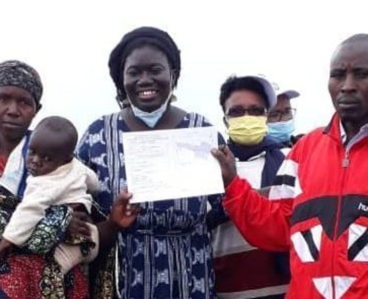
Today, on International Women's Rights Day, we are proud to see that more and more women are getting involved and achieving success in traditionally male-dominated fields, particularly in the field of geographic i... Continue reading
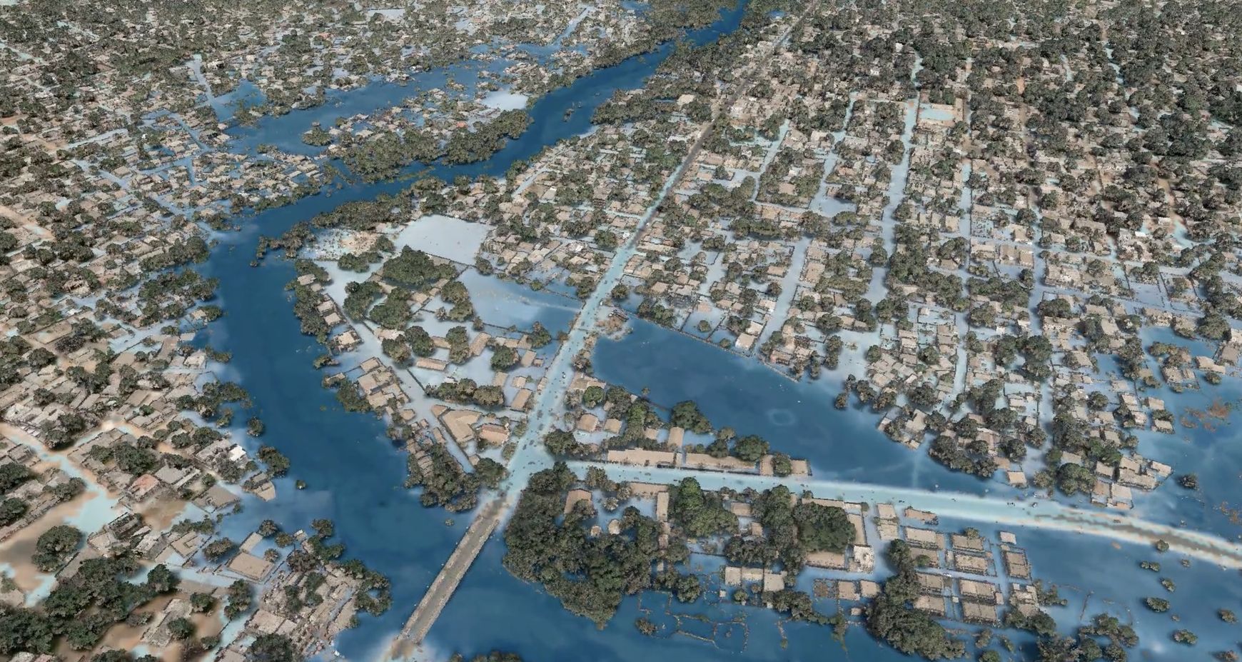
Senegal/ PGIIS project: impact of flooding on Kolda and Kedougou
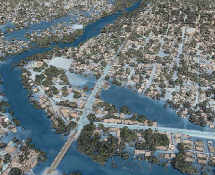
The presentation of the results of the Integrated Flood Management Project (PGIIS) in the Kolda area brought together all the stakeholders at the end of January. The mapping of the flood risk in the area models a ... Continue reading
IGN FI at the heart of the New Copernicus Service Global mapping and monitoring of land cover and tropical forests (LCFM)
In November 2023, the Joint Research Centre (JRC) of the European Commission and VITO signed a four-year framework contract for the deployment of the Copernicus LCFM service, marking a significant step forward in ... Continue reading
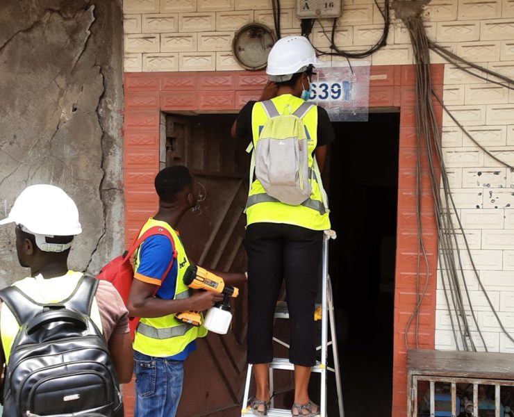
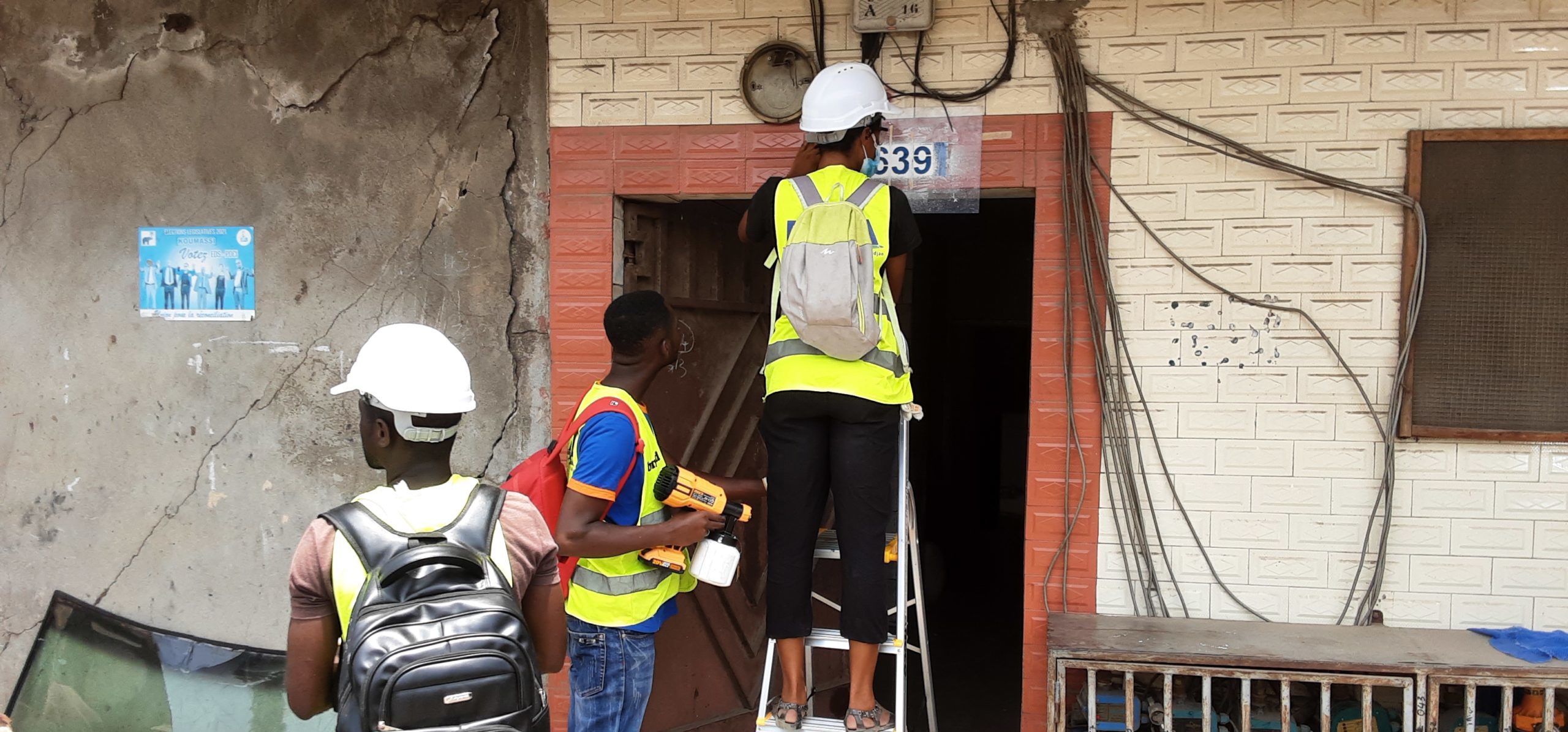
Ivory Coast/ PADA: Report on surveys and stenciling
The Abidjan District Addressing Project (Projet d'Adressage du District d'Abidjan - PADA) has taken significant steps towards achieving a comprehensive addressing system and a unified reference system. These advan... Continue reading
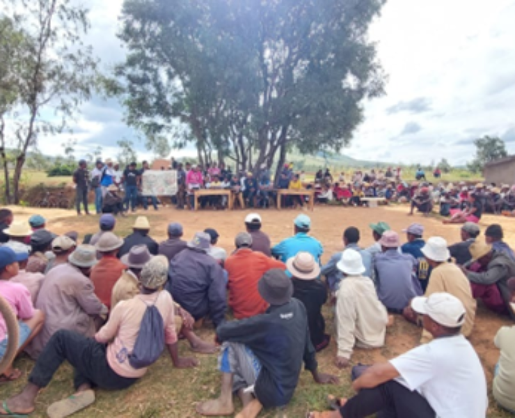
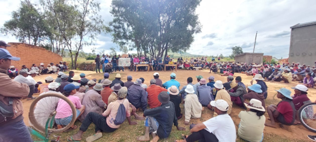
MADAGASCAR / CASEF Project: start of land certification operations and support to land offices
The consortium formed by IGN FI and Geosystems has begun land certification and support to land tenure offices in Madagascar in the regions of Amoron'i Mania, Haute Mahatsiatra, Vakinankaratra, Analamanga, Bongol... Continue reading